Our retirement on Island Time as liveaboards.
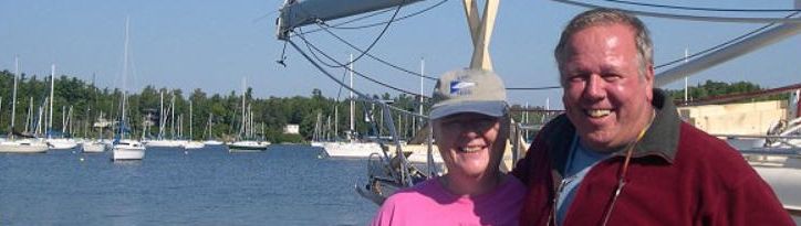
Martinique 2010, Part 2
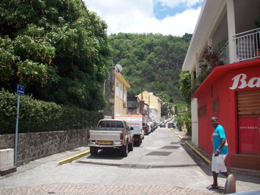
On the trip back from Fort de France we travelled in the country side a bit. There is a large amount of agriculture in Martinique especially banana plantations.
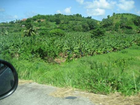
Banana Plantation
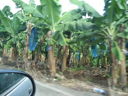
Once the Bananas form along the stalk a blue bag is placed around the
bunch of bananas to protect them from insects
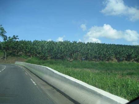
More banana trees
Before heading back to Ste. Anne and our boat we stopped at Anse de Saline, a popular beach just south east of Ste. Anne.

Anse de Saline – shallow sandy beach great for families
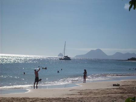
Our anchorage is around the rock outcropping to the right in this
picture
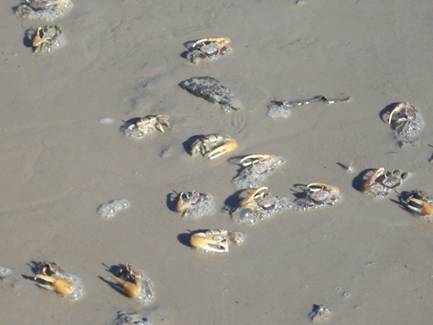
There is a natural area at Anse de Saline with a boardwalk. All we
saw were thousands of crabs
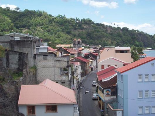
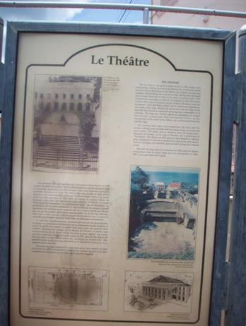
The second day of our land trip we headed toward Pierre at the north end of the island. This is the former economic hub of the island that was destroyed by a volcano in 1902. The following narrative is copied from the internet.
The infamous volcano of Mt. Pelée looms over the village of St. Pierre. This sleepy little village shows little of the grandeur of turn-of-the-century St. Pierre, which was a vibrant colonial city, known to European tourists as the "Paris of the West Indies." With its red-tiled cottages, rambling streets, and tropical vegetation, this prosperous little city was renowned for its beauty. In the official 1894 census, the population of St. Pierre was around 20,000. Although most were native Martiniquans, the wealth and political power were controlled largely by Creoles and a few French colonial officials and civil servants.
Although in January 1902 Mt. Pelée began to show an abrupt increase in fumarole activity, the public showed little concern. This changed, however, on April 23 when minor explosions began at the summit of the volcano. Over the next few days, St. Pierre was rocked by earth tremors, showered in ash, and enveloped in a thick cloud of choking sulfurous gas. These nightmarish conditions deteriorated further when the city and outlying villages were invaded by ground-dwelling insects and snakes driven from the slopes of Mt. Pelée by the ashfalls and tremors. Horses, pigs, and dogs screamed as red ants and foot-long centipedes crawled up their legs and bit them. Thousands of poisonous snakes joined the fray. An estimated 50 humans, mostly children, died by the snake bites, along with some 200 animals.
As the summit eruptions intensified, water in the Etang Sec crater lake was heated to near boiling. On May 5, the crater rim gave way, sending a torrent of scalding water cascading down the River Blanche. The hot water mixed with loose pyroclastic debris to generate a massive lahar with a downslope speed of nearly 100 kilometers per hour. This large volcanic mudflow buried everything in its path. Near the mouth of the river, north of St. Pierre, it overran a rum distillery, killing 23 workmen. The lahar continued into the sea, where it generated a three-meter-high tsunami which flooded the low-lying areas along the waterfront of St. Pierre.
Living near the volcano became increasingly stressful, leading many to consider leaving St. Pierre for Martinique's second city, Fort-de-France. On the day of the lahar, however, Governor Louis Mouttet received a report from a committee of civic leaders who climbed the volcano to assess the danger. The only scientist in the group was a local high school teacher. The report stated that "there is nothing in the activity of Mt. Pelée that warrants a departure from St. Pierre." It concluded that "the safety of St. Pierre is completely assured." The report eased the public's fears, and gave hope to city officials who were particularly anxious that voters remain in the city to cast their ballots for an election that was to be held on May 11. The only people with enough money to leave the island were the wealthy, nearly all of which belonged to the Progressive Party of Governor Mouttet. Mouttet convinced the conservative editor of the daily newspaper Les Colonies to downplay the danger of the volcano, and to lead the effort to encourage people to remain. Still, some residents left the city for Fort-de-France. This prompted Governor Mouttet to send in troops to patrol the road to Fort-de-France, with orders to turn back refugees who were trying to leave. Based on the soothing articles that appeared in Les Colonies, many people in the countryside flocked to St. Pierre thinking that it was the safest place to be. The population ballooned to about 28,000, nearly all of which would perish in the cataclysmic eruption of May 8.
The
election scheduled for May 11 would not take place. The report issued by
the investigating committee on May 5, failed to realize the potential
danger of a large V-shaped notch cut through cliffs surrounding the
summit crater. Th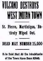 e notch was like a colossal gun sight pointing directly
at St. Pierre four miles below. At about 7:50 a.m. on May 8, the volcano
erupted with a deafening roar. A large black cloud composed of
superheated gas, ash and rock rolled headlong down the south flank of
Mt. Pelée at more than 100 miles per hour, its path
directed by the
V-shaped notch at the summit. In less than one minute it struck St.
Pierre with hurricane force. The blast was powerful enough to carry a
three-ton statue sixteen meters from its mount. One-meter-thick masonary
walls were blown into rubble and support girders were mangled into
twisted strands of metal. The searing heat of the cloud ignited huge
bonfires. Thousands of barrels of rum stored in the city's warehouses
exploded, sending rivers of the flaming liquid through the streets and
into the sea. The cloud continued to advanced over the harbor where it
destroyed at least twenty ships anchored offshore. The hurricane force
of the blast capsized the steamship Grappler, and its scorching
heat set ablaze the American sailing ship Roraima, killing most
of her passengers and crew. The Roraima had the misfortune of
arriving only a few hours before the eruption. Those on board could only
watch in horror as the cloud descended on them after annihilating the
city of St. Pierre. Of the ~28,000 people in St. Pierre, there were only
two known survivors.
e notch was like a colossal gun sight pointing directly
at St. Pierre four miles below. At about 7:50 a.m. on May 8, the volcano
erupted with a deafening roar. A large black cloud composed of
superheated gas, ash and rock rolled headlong down the south flank of
Mt. Pelée at more than 100 miles per hour, its path
directed by the
V-shaped notch at the summit. In less than one minute it struck St.
Pierre with hurricane force. The blast was powerful enough to carry a
three-ton statue sixteen meters from its mount. One-meter-thick masonary
walls were blown into rubble and support girders were mangled into
twisted strands of metal. The searing heat of the cloud ignited huge
bonfires. Thousands of barrels of rum stored in the city's warehouses
exploded, sending rivers of the flaming liquid through the streets and
into the sea. The cloud continued to advanced over the harbor where it
destroyed at least twenty ships anchored offshore. The hurricane force
of the blast capsized the steamship Grappler, and its scorching
heat set ablaze the American sailing ship Roraima, killing most
of her passengers and crew. The Roraima had the misfortune of
arriving only a few hours before the eruption. Those on board could only
watch in horror as the cloud descended on them after annihilating the
city of St. Pierre. Of the ~28,000 people in St. Pierre, there were only
two known survivors.
The first a young shoemaker, Léon Compere-Léandre, was sitting on his doorstep when the nuée ardente hit. Although he was severely burnt he survived, partly because of his good health, but also because his house was near the edge of the pyroclastic flow
The only other known survivor in St. Pierre became a minor celebrity. He was a husky 25-year-old roustabout named Louis-Auguste Cyparis, locally known simply as "Samson". In early April, Samson was put in jail for wounding one of his friends with a cutlass. Towards the end of his sentence, he escaped from a laboring job in town, danced all night, and then turned himself into the authorities the following morning. For this, he was sentenced to solitary confinement for a week in the prison's dungeon. On May 8, he was alone in his dungeon with only a small grated opening cut into the wall above the door. While waiting for his breakfast, his cell became dark and he was overcome by intense gusts of hot air mixed with ash that had entered through the grated opening. He held his breathe while experiencing intense pain. After a few moments, the heat subsided. He was severally burned, but managed to survive for four days before he was rescued by people exploring the ruins of St. Pierre. After he recovered, he received a pardon and eventually joined the Barnum & Bailey Circus, where he toured the world billed as the "Lone Survivor of St. Pierre."
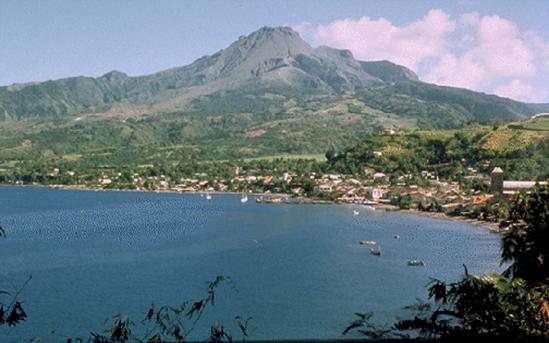
Mount Pelee looming above St Pierre
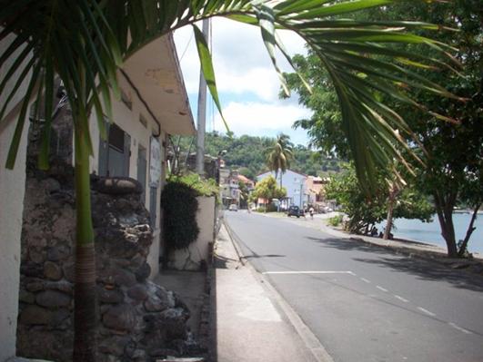
Main street of St Pierre along waterfront
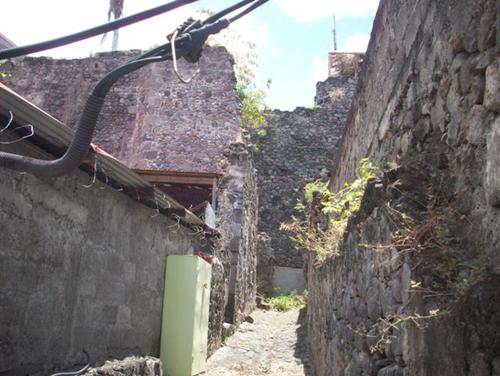
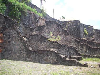
Some of the original walls built before the volcanic eruption. Many
current structures have one wall formed by one the original walls of the
city
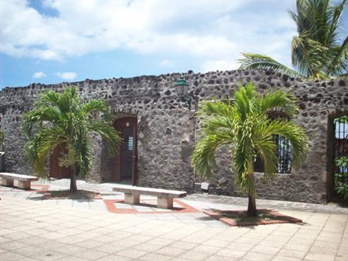
A new structure next to the remains of the old
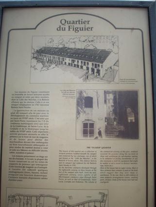
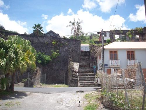
The remains of the building shown on the plaque shown above
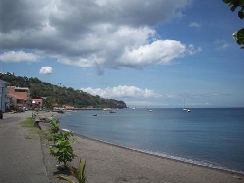
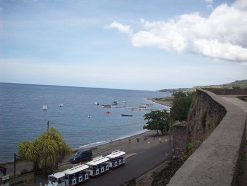
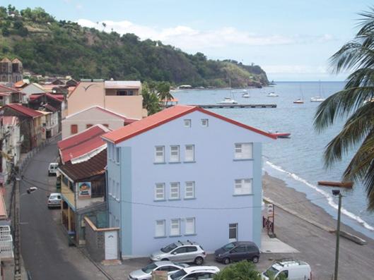
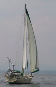
The waterfront with anchored yachts - Yachts can clear in and out of
Martinique in Pierre.
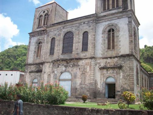
The following are pictures taken throughout the city
Looking north toward Dominica
Visitors
2011
Grenadines
New
2010
Martinique
St. Lucia
Trinidad
2009
New
Zealand P.16
New
Zealand P.15
New
Zealand P.14
New
Zealand P.13
New
Zealand P.12
New
Zealand P.11
New
Zealand P.10
New
Zealand P.9
New
Zealand P.8
New
Zealand P.7
Australia
Part 6
Australia Part 5
Australia
Part 4
Australia Part 3
Australia Part 2.5
Australia Part 2
Australia Part 1
Tyrell
Bay
View Past Logs![]()
2008 Winter
Carnival
![]()
Visitors Part
1
Visitors Part 2
March Visitors
Union Island
Easter Regatta
St. Vincent
Inland
Tour
April
Visitors
Young Island
Mustique
Mayreau
![]()
2007 Spring
Martinique
Bequia
2007 Winter![]()
2006 Summer
2006 Winter
2005 Fall
Photo
Albums
Maine
Aug 2006
Trinidad, Feb 2008
Slideshow
Trinidad, Grenadines
![]()
![]()