Our retirement on Island Time as liveaboards.
Island Time crew goes to Australia
Part 6
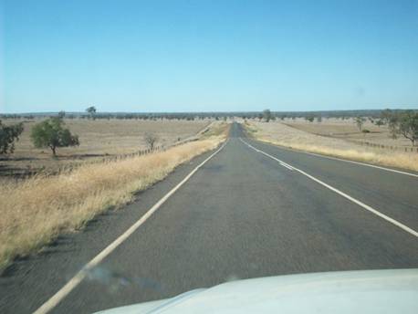
Day 19 We left Airlie Beach and headed south. We planned out return trip inland on the edge of the outback along the Great Inland Way. We left the coast at Makay and headed inland toward Clermont. Initially we took some secondary roads that only consist of one paved lane in the center with wide gravel shoulders. So when you meet a vehicle coming the other way you each move over and have one set of tires on the sealed part (paved) and one set of tires on the gravel shoulder. We were heading for a remote camp area but due to some rain, water was running over the road and we skipped that camp site.
Clermont was initially founded as part of a gold rush in 1861 and then copper in 1862. Now this area has a highly productive coal mining operation. Hugh strip mines are located along the highway; in fact a portion of the highway was relocated so the mine could expand.
Just south of Cappella we stopped for the night. S 23.08 degrees E 148.02 degrees
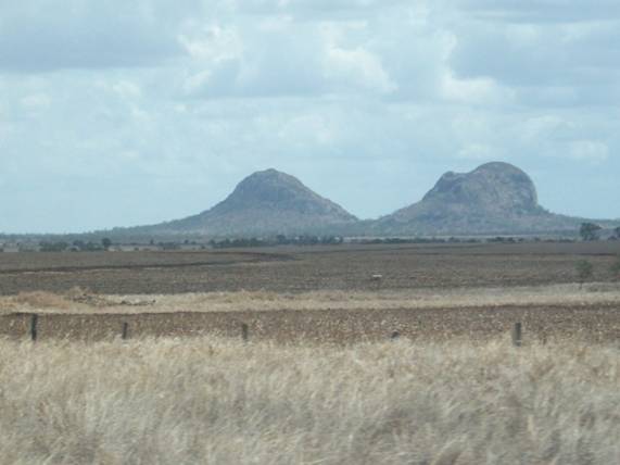
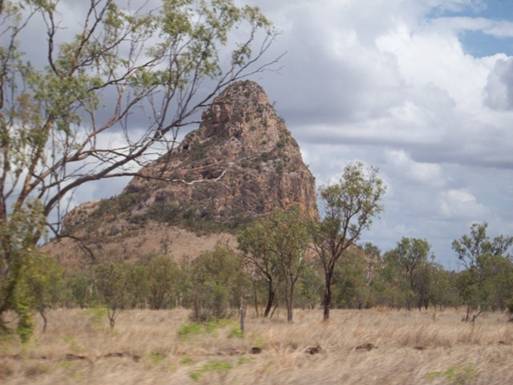
Arid
landscape with Peak Range National Park in Background
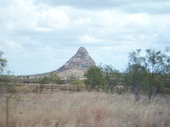
Peak National Park
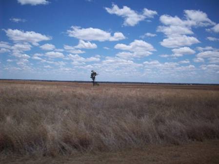
Day 20 We continued south and the land became more arid with cattle stations (ranches) getting larger. Along the road all one sees are post boxes for the stations. Terry told us that some of the stations further inland are larger than the state of Texas and they use airplanes to find the cattle. I can understand why the stations need to be as large as there is so little grass
The next town south of Capella is Emerald where we stopped at the information center. Located at the information center is the Centenary of Federation Mosaic Pathway. The walkway is imbedded with mosaics in the concrete that depict history from creation and into the future. Also at the site is a giant sunflower painting and some of the original houses that have been moved here.
South of Emerald is Rolleston which is off the main road where we decided to get gas which was a good plan as shortly after we leave Rolleston we see a sign that says no gas for the next 171 km. In fact there was nothing along this road – no stations, no turns – except a few roadside picnic areas.
We continued on to Roma where we spent the night. S 26.6 degrees E 148.8.degrees
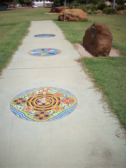
Mosaics in
the walkway – these depict the future
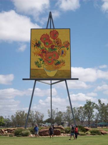
Giant Sunflower Painting
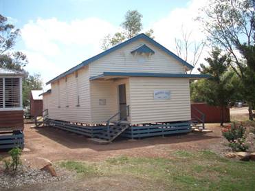
Original Church
Open land for miles
 t
t
More open land where the stock is allowed to roam free and
fences between property comes down to the road with grates
in the road keeping the stock on their own land (the American
ranchers use the same technique)
Day 21 We continue our trip south to Surat where we need more gas. The station is closed on Saturday and this is the only station in town. The station will let you get gas if you have their gas card. A very nice Aussi let us use his card and we gave him cash. Whew as it was 117 km to the next town. We continue on to Hebel where we had a nice lunch of meat pie at the General Store which is located in building that was originally a dance hall in the 1890’s. Hebel is the last town in Queensland before we reenter New South Wales.
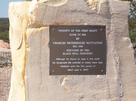
Our destination that day was Lightening Ridge (S 29.4 degrees; E 148.0 degrees) which is the location where world renowned black opal is mined. Black opal is a rare form of opal. The first opal was found in the 1880’s and the first shaft sunk in 1901.
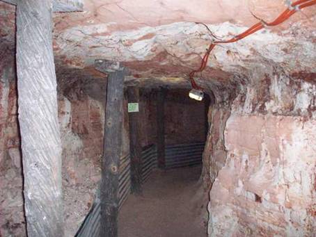
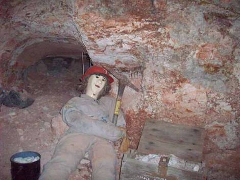
We arrived early in the day so we went on a tour of an opal mine. Opal is mined underground about 25 meters down using a jackhammer (of course the old days a pick axe was used). Each miner’s claim (licenses purchased from the government) is 50 meter by 50 meter. The miner digs a shaft down to the level that he believes the opal is located. The rock is sandstone with a layer of clay underneath. Usually the opal baring rocks are located in the clay layer where it meets the sandstone. This clay material is brought to the surface on conveyors and placed in drums with water – old cement mixers are generally used. The washing action cleans the clay soil off the rocks which are then inspected for opal. Most of the opal mining is carried on by individual miners with few finding enough opal to make it big.
Most of the opal from Lighting Ridge has been removed by the late 1990’s and the miners are working other areas close by.
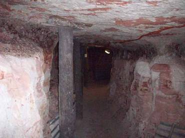
Mine with
supports – many miners have killed by not adequately bracing their mines
 .
.
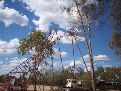
Conveyors
that brought the opal baring clay to the surface
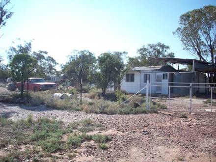
Typical
miner’s camp. There is no power to the camps so the miners
use generators, solar or wind to generate their electricity
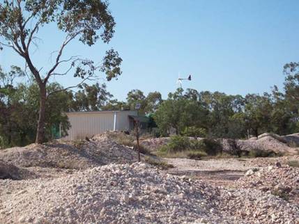
Piles of rubble from mining operation
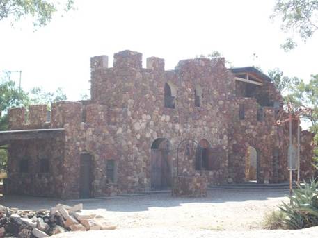
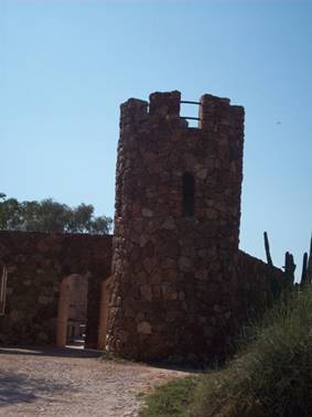
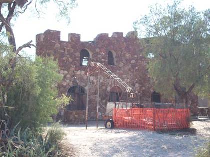
Amigo’s Castle is a private home built of ironstone. Started in 1981 it
was
Inspired by the Roman ruins in northern Italy, near Amigos birthplace.
The scaffolding consisted of 44-gallon drums, with planks arranged one
above the other. Underground there are trap doors, dungeons and tunnels
incorporated as part of Amigo’s mine.
The
orange fencing is around a shaft and the conveyor is
next to the shaft
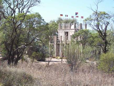
Astronomer’s monument – a concrete folly with inscriptions in
memory of famous astronomers
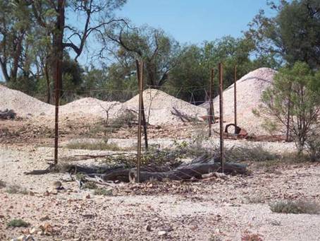
An abandoned mine shaft- covered with logs and surrounded
by a fence – the area has hundreds of these shafts littered about
Visitors
2011
Grenadines
New
2010
Martinique
St. Lucia
Trinidad
2009
New
Zealand P.16
New
Zealand P.15
New
Zealand P.14
New
Zealand P.13
New
Zealand P.12
New
Zealand P.11
New
Zealand P.10
New
Zealand P.9
New
Zealand P.8
New
Zealand P.7
Australia
Part 6
Australia Part 5
Australia
Part 4
Australia Part 3
Australia Part 2.5
Australia Part 2
Australia Part 1
Tyrell
Bay
View Past Logs![]()
2008 Winter
Carnival
![]()
Visitors Part
1
Visitors Part 2
March Visitors
Union Island
Easter Regatta
St. Vincent
Inland
Tour
April
Visitors
Young Island
Mustique
Mayreau
![]()
2007 Spring
Martinique
Bequia
2007 Winter![]()
2006 Summer
2006 Winter
2005 Fall
Photo
Albums
Maine
Aug 2006
Trinidad, Feb 2008
Slideshow
Trinidad, Grenadines
![]()
![]()